
Buying a luxury waterfront home in Clearwater: Gulf-front, Intracoastal, bay-front, and canal compared
By Terri Novitsky, Broker, Lauren Michaels Real Estate Partners · Published October 7, 2026
In Clearwater, “waterfront” covers four different kinds of property: Gulf-front homes on the beach, homes on Clearwater Harbor and the Intracoastal Waterway, bay-front homes on Old Tampa Bay, and canal homes on seawalled residential waterways. Each one trades off view, boating access, flood exposure, insurance cost, and upkeep in its own way. Before a buyer tours a single luxury waterfront home in Clearwater, I ask them to decide which of those trade-offs they actually want.
This guide compares the four water types, then covers the four things that separate a good waterfront purchase from an expensive surprise: bridges, docks and seawalls, flood zones, and insurance.
The four types of waterfront in Clearwater, side by side
|
|
Gulf-front |
Intracoastal / Clearwater Harbor |
Bay-front (Old Tampa Bay) |
Canal |
|---|---|---|---|---|
|
Where you’ll find it |
Clearwater Beach, Sand Key, Belleair Beach, Belleair Shore, Indian Rocks Beach |
Harbor side of Clearwater Beach and Sand Key, the bluffs of Harbor Oaks and Belleair, Dunedin |
Safety Harbor and Clearwater’s east side |
Island Estates, canal streets on Clearwater Beach, parts of Dunedin and Palm Harbor |
|
What you get |
Sand, open Gulf views, sunsets |
Wide, protected water and room for a dock |
Sunrise views over the bay |
A private dock at your back door on protected water |
|
What limits it |
Usually no private dock on the Gulf side; the strictest flood and coastal construction rules |
Wind and wake on open stretches; dock permitting |
Water depth close to shore varies widely |
Bridges and canal depth set your boat size; you own the seawall |
|
Check first |
Flood zone, Coastal Construction Control Line, elevation |
Depth at the dock, seawall age |
Depth at low tide, dock feasibility |
Route to open water, lowest bridge, seawall condition |
Across the bay, the same framework applies to Tampa’s waterfront neighborhoods, such as Davis Islands and Bayshore Boulevard. Each will get its own guide.
Gulf-front: the view, with the most rules
Gulf-front homes sit directly on the beach: sand at the end of the yard and the sunset over open water. They also carry the strictest building rules in the region. Beachfront parcels are often mapped in FEMA’s highest-risk coastal flood zone, and most construction seaward of Florida’s Coastal Construction Control Line needs a separate permit from the Florida Department of Environmental Protection’s CCCL program. If you plan to add a pool, expand a deck, or rebuild, those rules shape what’s possible, so we check them before you write an offer. Gulf-front owners who boat often keep the boat at a nearby marina.
Intracoastal and Clearwater Harbor: the boater’s water
Clearwater Harbor is the protected stretch of the Intracoastal Waterway between the mainland and the barrier islands. Homes here get wide water views and, in many cases, room for a dock with a route to the Gulf through Clearwater Pass. Harbor Oaks and parts of Belleair sit on bluffs above the harbor, which can mean more elevation than homes on the islands. The elevation certificate confirms it, house by house.
Bay-front on Old Tampa Bay: the sunrise side
On Clearwater’s east side and in Safety Harbor, waterfront homes face Old Tampa Bay, so you get sunrise instead of sunset. Water depth near shore changes a lot along the bay. If a dock or boat lift is part of the plan, get the depth measured at the property before you commit.
Canal homes: a dock at the back door
Canal homes line seawalled residential waterways. Island Estates, just off the Memorial Causeway, is a clear Clearwater example: a network of canals where many homes have private docks. Canals give you protected water and easy dockage. The trade-offs are the trip out (bridges, depth, and distance to open water) and the seawall you’ll own and maintain. Salt air and seawalls add a maintenance routine of their own; here’s what upkeep on a waterfront home involves.
Boating: the lowest bridge on your route sets the limit
If you own a boat or plan to buy one, measure its air draft (height above the waterline) and its draft (depth below it) before you shop. Then trace the route from each candidate dock to open water.
Clearwater’s main causeways are high fixed bridges. The Memorial Causeway bridge was built with roughly 74 feet of vertical clearance over the Intracoastal, according to the Florida Department of Transportation’s Memorial Causeway bridge study. The limit is more often a smaller bridge inside a neighborhood, or the water depth at low tide. Some routes along the beaches also cross drawbridges, such as the Indian Rocks Causeway, which adds opening schedules to your trip. For a wider look at boating neighborhoods around the region, see our guide to boating communities in Tampa Bay.
On every waterfront listing, ask for three things:
-
Water depth at the dock at mean low water, measured, not estimated
-
The lowest fixed bridge between the dock and the Gulf, confirmed on a current nautical chart
-
Dock length, lift capacity, and the permits behind both
Docks, lifts, and seawalls: what the paperwork should show
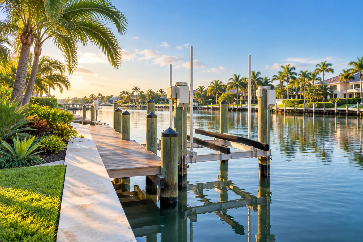
In Pinellas County, docks, seawalls, riprap, tie poles, and dredge-and-fill work are permitted through the County’s Water and Navigation section, in unincorporated areas and inside city limits. Inside the City of Clearwater, the city’s planning department pre-approves dock plans before the County application, and a boat lift needs its own building permit, per the City of Clearwater marine and dock permit checklist.
For a buyer, that means the dock and lift you’re paying for should come with a paper trail. Before the inspection period ends, I want to see:
-
Permit history for the dock, lift, and seawall, and whether any permits are still open
-
The seawall’s age and last repair, plus an inspection by a licensed marine contractor or engineer
-
A survey that shows the seawall and dock
-
The seller’s flood disclosure
Florida sellers of residential property must give buyers a written flood disclosure at or before contract, under section 689.302 of the Florida Statutes. Since October 1, 2025, it covers whether the seller knows of flood damage during their ownership, whether they filed a flood insurance claim, and whether they received federal flood assistance, as Florida Realtors explains. On a waterfront home, read it next to the elevation certificate and the permit history.
Flood zones: VE, AE, and the line in between
Every waterfront home has a FEMA flood zone, and it affects your insurance, your lender, and what you can build. Two zones come up most on the coast:
-
Zone VE is a coastal high hazard area, where FEMA expects waves of 3 feet or more during a flood with a 1% chance of happening in any year. Buildings there must meet the strictest construction standards.
-
Zone AE has the same 1% annual flood chance, with waves expected under 3 feet.
Some coastal maps also show a Limit of Moderate Wave Action. The strip between that line and Zone VE, called the Coastal A Zone, can see waves of 1.5 to 3 feet, according to FEMA’s guide to coastal flood maps.
You can look up any address on the FEMA Flood Map Service Center. The zone is only half the story. The elevation certificate shows how high the home’s lowest floor sits compared with the base flood elevation, which matters for flood insurance and for any future permits. Many waterfront sellers already have one, so ask for it early.
After Helene and Milton: the 50% rule
Hurricanes Helene and Milton in 2024 damaged homes on Clearwater Beach, Sand Key, and Indian Rocks Beach, and many are still being repaired, elevated, or rebuilt. If a home in a mapped flood zone needs repairs or improvements costing 50% or more of the building’s market value (land isn’t counted), the whole structure has to meet current floodplain standards, which can mean elevating it. That’s the rule described in FEMA’s substantial improvement and substantial damage fact sheet, and communities can adopt stricter thresholds. If you’re buying a home that hasn’t been fully repaired, or planning a major renovation, ask that city’s building department how the rule applies to the address before you set a budget. I’ll cover the 50% rule in more detail next month.
Insurance: price it during your inspection period
Standard Florida homeowners policies don’t cover flood, so waterfront owners usually carry a separate flood policy on top of homeowners coverage. Three rules catch buyers off guard:
-
Lenders require flood insurance on homes in high-risk A and V zones when the mortgage is federally backed.
-
Citizens Property Insurance requires most personal residential policies that include wind coverage to also carry flood insurance, under a phase-in that reaches all remaining policies by January 1, 2027 (section 627.715, Florida Statutes).
-
A new NFIP flood policy usually has a 30-day waiting period. The main exception is a policy bought in connection with a new loan, which means cash buyers generally wait the full 30 days. Check details with your agent or on FloodSmart, the NFIP’s official site.
Insurers also typically stop writing new policies once a storm watch or warning is issued. If you’re closing during hurricane season (June 1 through November 30), get homeowners and flood quotes in the first days of your inspection period.
Which water type fits how you’ll use the home?
-
Sand and sunsets, boat kept elsewhere or not at all: Gulf-front.
-
A larger boat and a fast run to open water: Intracoastal or harbor frontage with measured depth and no low bridges on the route.
-
A private dock on protected water: canal.
-
Sunrise over the bay: bay-front on Old Tampa Bay.
-
Elevation first: compare elevation certificates across all four types, and look at bluff homes in Harbor Oaks and Belleair.
What to do next
-
Write down your boat’s length, air draft, and draft, or the specs of the boat you plan to buy.
-
Look up the flood zone of any address you’re considering on the FEMA Flood Map Service Center.
-
Once you’re serious about a home, ask for the elevation certificate, survey, permit history, and flood disclosure.
-
Get homeowners and flood insurance quotes in the first days of the inspection period. If you’re paying cash, start the flood policy right away because of the 30-day wait.
-
Tour at least two water types on the same day. The differences are obvious in person.
Buying from out of state? We run virtual tours, coordinate inspections, and manage closings for buyers who can’t be here. Read what remote buyers have said about working with us. When you’re ready, search current Clearwater and Tampa Bay listings or schedule a private consultation with Broker Terri Novitsky.
Frequently asked questions
Is Gulf-front or Intracoastal better for boating in Clearwater? If you want to keep a boat at home, harbor or canal frontage usually works better, because Gulf-front homes typically don’t have private docks on the beach side. Confirm water depth at the dock and the lowest bridge on the route before you buy.
Do I need flood insurance on a waterfront home in Clearwater? Your lender will require it if the home is in a high-risk flood zone and the mortgage is federally backed. Citizens also requires it for most policies with wind coverage on its phase-in schedule. Even when no one requires it, most waterfront owners carry it because standard homeowners policies exclude flood.
What is an elevation certificate, and where do I get one? It’s a form completed by a licensed surveyor, engineer, or architect that shows a building’s elevation compared with the base flood elevation. Ask the seller first; many waterfront owners have one. If not, a local surveyor can prepare it.
How can I tell whether a home was damaged in the 2024 hurricanes? Start with the seller’s flood disclosure, then request permit records for repairs since fall 2024 and have your inspector look closely at walls, flooring, and electrical systems at the lowest level. Your agent should help you line up the documents.
This article is for general information only and is not legal, tax, insurance, or financial advice. Market figures reflect the sources and dates cited and change quickly. Consult a qualified attorney, CPA, or insurance professional about your situation. Lauren Michaels Real Estate Partners is a licensed Florida real estate brokerage. Equal Housing Opportunity.
About the author
Terri Novitsky is the broker and owner of Lauren Michaels Real Estate Partners in Clearwater, Florida (Florida broker license BK3316546, which you can check on the Florida DBPR license lookup). She represents buyers and sellers of waterfront homes, luxury condominiums, and investment and commercial property across Tampa Bay. Read more about Terri.
